Oxford Gold, Manitoba
Overview
Ownership & Size: Big Ridge (formerly Alto) – 100%
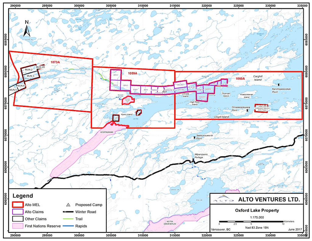
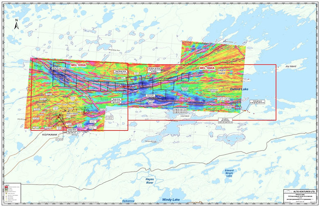
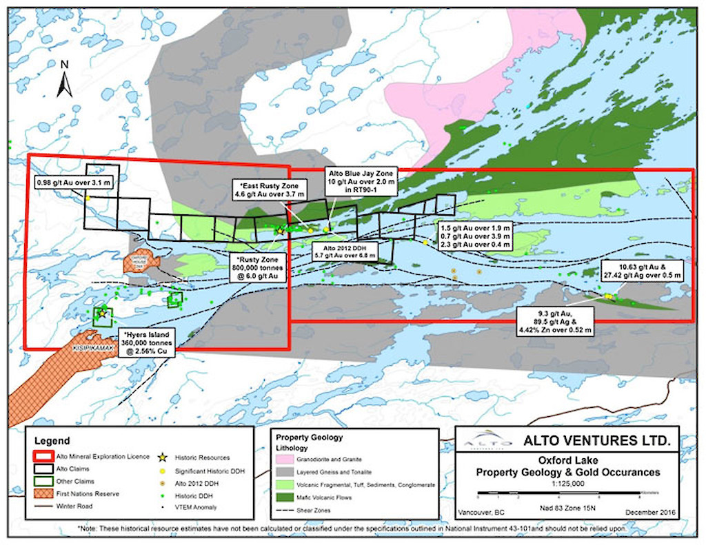
Property includes 17 contiguous mineral claims and three Mineral Exploration Licenses which combined cover approximately 35,992 haStage: Highly prospective mid stage project with numerous untested gold occurrences along a 30km trend. Historical drilling led to the discovery of the Banded Iron Formation (BIF) associated Rusty Deposit with reported historical Resource of 800,000 tonnes grading 6 g/t Au, containing 150,000 ounces*. The Rusty deposit remains open along strike and at depth. In 2012 Alto drilled the Blue Jay Zone, which includes two separate zones of high-grade gold mineralization on trend to the east of the Rusty Deposit.
* The Historical Resource was estimated in 1990 by Noranda Inc. A Qualified Person (QP), as defined by NI43-101, has not done sufficient work to classify this historical estimate as current mineral resources. Alto is not treating the historical estimate as current mineral resources, as defined by NI 43-101, and thus the historical estimate should not be relied upon.
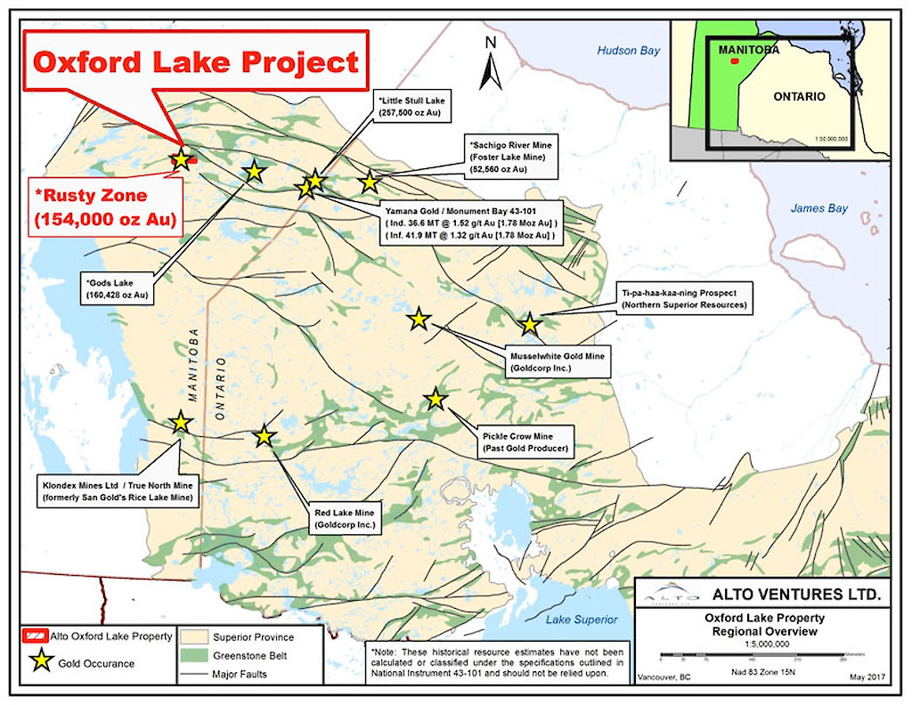
Location & Infrastructure Located in central Manitoba, approximately 150 km southeast of Thompson. Access to the property can be gained by float or ski equipped aircraft or by winter road.
Regional Significance One of the largest underexplored greenstone belts within the Western Superior Province of the Canadian shield. The Oxford Lake property lies in the southwest portion of the Archean age Oxford-Knee Lake greenstone belt in the Oxford-Stull Domain of the western Superior Province of Manitoba. Major structures include an anastomosed array of regional-scale shear zones that appear to merge toward the east of Oxford Lake into the crustal-scale Stull-Wunnummin Fault, which defines the south margin of the Oxford–Stull Domain and is thought to represent a fundamental tectonic boundary in the northwestern Superior Province.
The Monument Bay gold deposit is located approximately 150 km east from Oxford Lake along the same structural trend. Reported Indicated Resources are 36.6 million tonnes averaging 1.52 g/t Au containing 1.78 million ounces of gold and Inferred Resources are 41.9 million tonnes averaging 1.32 g/t Au containing 1.78 million ounces of gold (Source: Yamana Gold Annual Report, 2018). There are also a number of past producing gold mines in proximity to the Stull-Wunnimmin Fault Zone.
Project Summary - Property located along major crustal-scale structure
- Historical resources of 800,000 tonnes averaging 6 g/t Au at the Rusty Deposit - mineralization is open along strike and at depth
- Gold is associated with a BIF sequence that has been traced along strike for 30 km
- Significant gold was drilled in multiple zones at the Blue Jay, located two km east of the Rusty Deposit:
Table 1: Rusty Deposit High-Grade Gold Intercepts from Limited 2012 Drilling Conducted by Alto
Hole Name
From (m)
To (m)
Width (m)
g/Au/tonne
RUS12-03
includes
includes
includes
134.8
136.5
198.65
200.6
203.0
137.5
137.0
205.45
202.6
204.0
2.7
0.5
6.8
1.6
1.0
6.7
22.5
5.7
11.7
16.5
*The widths reported are down-hole lengths as there is insufficient drilling density to determine the true widths. Mineralized zones generally start at 0.1 g/t gold and assay averages may include minimal intervals of waste material. No top cuts of assays were used.
- Only two diamond drill holes were completed in the 10 km segment of the BIF trend west-northwest of the Rusty Deposit, one of these holes intersected wide sections of BIF, one of which assayed 0.98 g/t Au over 3.1 m
- Numerous other gold and base metals occurrences on the property have not been explored in detail
Outlook
Highly prospective property with very limited drilling completed to date.
A planned $1.3 million drill program in early 2018 to test the Rusty trend was deferred due to delays in obtaining a drill permit from the Manitoba government and a request from the Bunibonibee Cree Nation to complete a comprehensive exploration agreement.
In December 2018, Big Ridge received a conditional work permit to carry out exploration programs consisting of line cutting, ground geophysics and 3,000 m of diamond drilling, subject to first completing a Heritage Resource Impact Assessment (HRIA) study satisfactory to the Historic Resource Branch of Manitoba Sport, Culture and Heritage. Requests for tenders from several archaeological consultants that support "Best Practices" in consultation with First Nations have been obtained. Subject to certain conditions, it is anticipated that the HRIA will be completed in early 2021.
Big Ridge signed a long-term exploration agreement with the Bunibonibee Cree Nation (BCN) in October 2020. This agreement provides long-term certainty of tenure to ultimately advance the Oxford Gold Project to the Bankable Feasibility Study Stage. The agreement enhances BCN and Big Ridge's existing relationship of mutual respect and demonstrates that Manitoba is a jurisdiction in which the untapped mineral potential can be explored and developed for the benefit of all stakeholders.
Maps